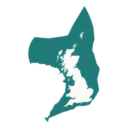
Country
Danish offshore data
12 open Danish offshore datasets for the North Sea, Skagerrak, Kattegat and western Baltic, from GEUS, EMODnet and DEA, on one map with live vessels, metocean stations and the other national data around the North Sea and Baltic.
Offshore wind and marine energy
Danish offshore wind parksEMODnet · Creative Commons Attribution 4.0 International (CC BY 4.0)
Wrecks, munitions and hazards
Danish-sector wrecksEMODnet · Creative Commons Attribution 4.0 International (CC BY 4.0)
Oil, gas and carbon storage
Danish hydrocarbon fieldsGEUS · GEUS open subsurface data terms
Danish licencesGEUS · GEUS open subsurface data terms
Danish offshore blocksGEUS · GEUS open subsurface data terms
Danish offshore installationsDEA · Danish Energy Agency public shapefile terms
Danish offshore sheetsGEUS · GEUS open subsurface data terms
Danish wellsGEUS · GEUS open subsurface data terms
Cables and pipelines
Danish pipelinesGEUS · GEUS open subsurface data terms
Seabed, geology and surveys
Danish 2D seismic linesGEUS · GEUS open subsurface data terms
Danish 3D seismic surveysGEUS · GEUS open subsurface data terms
Danish seabed substrateEMODnet · Creative Commons Attribution 4.0 International (CC BY 4.0)
Data sources and licences
Each layer comes from the provider's open data and is refreshed by the atlas's weekly update. Check the provider's own service for authoritative values and terms.
- Geological Survey of Denmark and Greenland — GEUS open subsurface data terms. Source
- European Marine Observation and Data Network — Creative Commons Attribution 4.0 International (CC BY 4.0). Source
- Danish Energy Agency — Danish Energy Agency public shapefile terms. Source
On the map
- Choose DK under Browse in the map's layer panel to list the Danish layers, then switch them on alongside UK and other national data.
- Search named features such as wind farms, fields, wrecks and protected areas from the search box.
- Draw or upload an area of interest in open data search to list and export every dataset that intersects it.
- See live vessel traffic, metocean stations and offshore helicopters over the same waters.
Other countries
Norway · Netherlands · Germany · France · Sweden · Finland · Estonia · Latvia · Lithuania · Poland · UK datasets